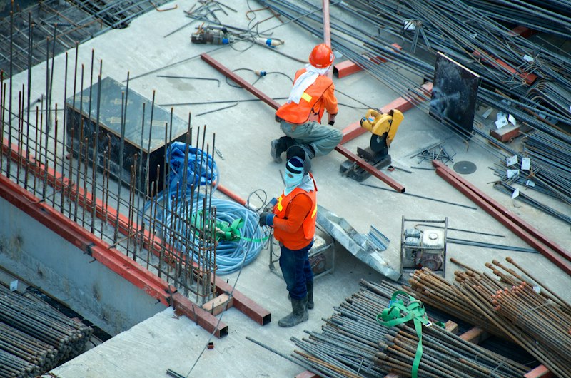
Chicago Drone Service helps developers reduce risk, improve stakeholder communication, document construction progress, and create valuable long-term project assets through aerial documentation, orthomosaic mapping, 3D digital twins, and executive-ready reporting.
That positions us as a business solution, not a drone pilot. We don't just deliver footage — we deliver the complete documentation package that protects your timeline, your billings, and your reputation across the entire life of a project. One avoided dispute, one accelerated lender draw, one additional retail tenant, or one marketing campaign can return many times the cost of the program.
See It In Action
Recent aerial documentation from active Chicago-area construction sites.
Construction Site — Aerial Time-Lapse
Progress documented from the air over time for stakeholder reporting.
Construction Progress — Aerial Capture
On-site aerial documentation delivered for ongoing progress tracking.
Construction Progress Documentation
A complete visual record of every phase of construction — captured before walls, concrete, and finishes conceal the work.
- Creates a visual record of every phase of construction
- Reduces disputes between owners, contractors, and subcontractors
- Documents work before walls, concrete, and finishes conceal it
- Provides evidence for insurance claims and legal disputes
- Helps executives monitor progress without visiting the site
- Keeps investors informed and engaged
- Creates a historical archive of the entire project
Investor & Lender Reporting
Professional, objective visual updates that build stakeholder confidence and keep capital moving.
- Professional visual updates for banks and investors
- Demonstrates project momentum
- Increases confidence among stakeholders
- Simplifies progress reporting meetings
- Helps justify construction draw requests
- Provides objective documentation of completed work
Orthomosaic Mapping
Your entire site visible in a single high-resolution, measurable map — the backbone of site intelligence.
- Entire site visible in a single high-resolution map
- Accurate measurements without visiting the site
- Tracks material staging and equipment placement
- Improves coordination between trades
- Assists with site logistics planning
- Documents site conditions over time
- Supports change-order discussions
3D Digital Twin Modeling
A permanent, measurable digital version of the project that keeps delivering value long after completion.
- Creates a permanent digital version of the project
- Allows remote inspections and reviews
- Tracks changes over time
- Assists with future maintenance planning
- Supports facility management after completion
- Creates a valuable asset for future renovations
- Provides a modern, technology-forward image for the developer
Executive Dashboard Reporting
Consolidated, leadership-ready reporting that turns raw imagery into fast decisions.
- Gives leadership a quick understanding of project status
- Reduces unnecessary site visits
- Consolidates progress into a single report
- Highlights milestones and potential issues
- Improves communication between ownership and construction teams
Volumetric Measurement & Earthwork
Stop estimating stockpiles and start measuring them — accurately, repeatedly, and without shutting operations down. This is where the math literally pays for the flight.
- Stockpile volume reports for aggregate, soil, and material — so you stop over-ordering trucks, over-paying haulers, or under-billing for material moved
- Cut-and-fill and elevation analysis — DEM/DSM models and contour maps so earthwork gets bid from real numbers, not guesses
- Excavation progress tracking with volume reporting — billable cubic yards documented period over period, so pay apps go uncontested
- Period-over-period change reports — we compute the delta and hand it to you in a format your CFO understands
Marketing & Leasing Content
Documentation that does double duty — protecting the project and selling it at the same time.
- Attracts future tenants earlier
- Creates excitement around the project
- Generates social media content throughout construction
- Helps pre-lease residential units
- Helps attract retail tenants
- Creates professional website content
- Increases project visibility in the community
Community Relations
Transparent, visual progress that keeps neighbors, city officials, and the surrounding community on your side.
- Shows transparency to neighborhood stakeholders
- Demonstrates progress to city officials
- Creates positive public perception
- Reduces concerns about project delays
- Helps maintain support from the surrounding community
Construction Time-Lapse
The entire construction journey captured in one powerful, reusable asset.
- Captures the entire construction journey
- Creates powerful marketing content
- Useful for future project proposals
- Great for investor presentations
- Can be used in award submissions
- Demonstrates the developer's capabilities
Roof & Building Envelope Documentation
Baseline conditions documented before warranty periods begin — so surprises don't show up after substantial completion.
- Documents conditions before warranty periods begin
- Creates a baseline for future inspections
- Identifies defects early
- Reduces long-term maintenance costs
- Supports warranty claims
- Helps property management teams
Thermal Drone Inspections
Infrared documentation that catches moisture and energy problems invisible to the naked eye.
- Identifies moisture intrusion
- Detects insulation deficiencies
- Locates roof leaks
- Reduces maintenance costs
- Supports preventative maintenance programs
- Extends roof life
Why Large Developments Should Care
For a major mixed-use project — hundreds of apartments, multiple retail buildings, a parking structure, a multi-year schedule, and numerous contractors and stakeholders — a complete documentation package is a small line item against the budget. One avoided dispute, one accelerated lender draw, one additional retail tenant, or one marketing campaign can easily return many times that investment.
Whether you're a GC running a single high-rise build or a developer managing several projects across the Chicagoland area, we deliver the aerial documentation and site intelligence that protects your timeline, your billings, and your reputation.
Preconstruction & Rapid Response
Two construction-specific services bookend the recurring program. Preconstruction existing-conditions documentation creates a date-stamped baseline of sidewalks, streets, adjacent properties, and pre-existing damage before work begins — the cheapest insurance on the project. And when something time-sensitive happens mid-build — storm damage, flooding, work about to be concealed, a potential dispute — rapid-response documentation gets the condition on the record while it still exists.
Construction Documentation Packages
Three ways to structure a program. Documentation visits start at $1,275 per visit for one-time projects, dropping to $950 per visit on recurring monthly or bi-weekly programs. Every package is scoped to your project — custom scope is always available, and final pricing depends on site size, frequency, deliverables, airspace, and reporting requirements.
Project Record
Best for smaller projects or monthly oversight. The business problem it solves: you need a professional, consistent record without a heavy program.
- One scheduled visit per month
- Standard aerial photographs from repeatable viewpoints
- One aerial 360-degree capture set
- Short progress video
- Organized cloud delivery with selected marketing-ready images
Project Progress
Best for active commercial construction. The business problem it solves: fast-moving phases get concealed before they're documented, and owners and lenders want visibility between site visits.
- Weekly or biweekly visits with standardized aerial documentation
- Multiple 360 viewpoints and an orthomosaic map
- Progress video and side-by-side comparisons
- Executive summary with each delivery
- Marketing-ready photos and a hosted archive
Project Intelligence
Best for large, complex, or multi-stakeholder projects. The business problem it solves: many stakeholders, long schedules, and high dispute exposure demand a complete, defensible record and custom reporting.
- Weekly or biweekly program with a custom capture protocol
- Mapping and measurement support, plus 3D model updates
- Executive progress reports and owner/lender reporting
- Preconstruction existing-condition baseline included
- Rapid-response scheduling priority
- Interior and exterior documentation with a dedicated project archive
Not sure which fits? Tell us about the project and we'll recommend a structure — most consultations turn around within one business day.
How a Documentation Program Works
Great documentation comes from consistency, not one-off flights. We set a recurring cadence matched to your draw schedule and milestones, fly from the same vantage points each visit, and deliver in a predictable format so every report lines up with the last. That repeatability is what makes change detection, side-by-side comparisons, and lender reporting genuinely useful.
- Kickoff and shot planning — we map vantage points, flight paths, and the deliverables your team needs before the first flight
- Recurring capture — weekly, biweekly, or monthly flights on a fixed schedule, with rapid-response visits when something needs eyes on it
- Processing and analysis — orthomosaics, models, and measurements produced and quality-checked, not just raw footage dumped in a folder
- Delivery — hosted links, executive summaries, and exports your owners, lenders, and trades can open without special software
Choosing the Right Cadence
Fast-moving phases — sitework, foundations, structure, and enclosure — change daily and reward weekly or biweekly capture. Interior fit-out and finishes change more slowly, so monthly flights usually cover them. We help you pick a cadence that documents the work before it gets concealed without paying for flights you don't need. For multi-project portfolios, this often rolls up into a structured enterprise documentation program with one point of contact across every site.
Built on Measurable Site Intelligence
Progress photos tell the story; measurements settle the argument. Our construction documentation is built on the same toolset we use across Chicagoland — orthomosaic mapping for measurable site maps and volumetrics, 3D digital twins for remote walk-throughs and facility handover, and thermal drone inspections for moisture and envelope issues before warranties begin. Not sure documentation by drone is worth it versus the old way? Our why drones page lays out the cost, speed, and safety case.
Local Chicago Knowledge, Fully Insured
Construction sites in Chicago sit inside some of the busiest airspace in the country — near O'Hare and Midway, downtown, and along the lakefront. As an FAA Part 107 Remote Pilot in Command based here, Dan Gierke handles LAANC authorizations and waivers so flights happen legally and on schedule, and we carry full liability insurance with certificates available for your risk team. We document projects throughout the city and across the suburbs; see the full list of areas we serve.
Frequently Asked Questions
What does a construction documentation program include?
A typical program combines recurring progress photos and video, measurable orthomosaic maps, optional 3D digital twins, volumetric and earthwork measurements, time-lapse, and executive-ready reports — all captured on a consistent schedule so the record stays comparable over time.
How often should my Chicago site be flown?
Most active projects run monthly, with weekly or biweekly capture during fast phases like sitework, structure, and enclosure. We match the cadence to your draw schedule and milestones so nothing important gets concealed before it's documented.
How does this help with disputes and claims?
Every capture is time-stamped and geo-referenced, creating an objective record of what was built and when. That documentation settles questions between owners, GCs, and subcontractors and supports insurance and warranty claims.
Can the reports support lender and investor draws?
Yes. Objective, professional progress documentation helps justify draw requests, demonstrates momentum to banks and investors, and makes reporting meetings faster — which keeps capital moving.
Do you handle airspace and insurance?
We do. We manage LAANC authorizations and waivers for controlled airspace near O'Hare, Midway, downtown, and the lakefront, and we're fully insured with certificates of insurance available on request.
Request a Free QuoteReady to set up documentation for your project? Call Chicago Drone Service at 773-213-6859.