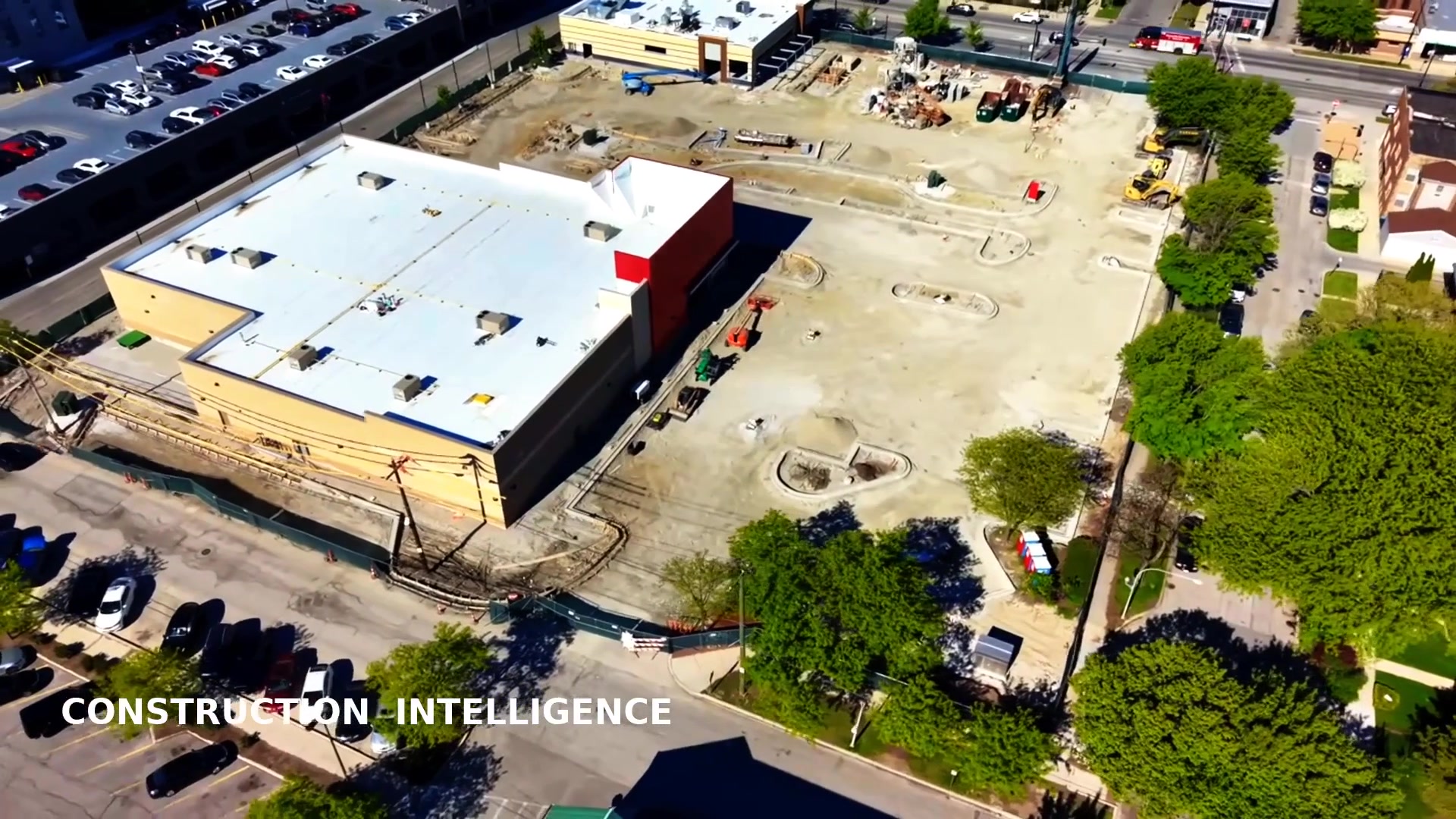
Establish what was already present before work begins. Before demolition, excavation, renovation, or heavy site activity starts, Chicago Drone Service creates a date-stamped visual baseline of your site and everything around it. Months later, when a neighbor claims your equipment cracked their sidewalk or a façade was damaged by your crane, you have organized, time-stamped documentation of the condition it was in before your crew ever arrived.
It's one of the least expensive forms of risk management on a construction project — one coordinated capture visit, before mobilization, that can save weeks of arguments later.
Why Contractors Document Before Breaking Ground
- Pre-existing damage gets blamed on the contractor. Cracked sidewalks, curb damage, and façade deterioration existed long before your project — but without a baseline, that's hard to demonstrate.
- Neighboring-property claims arrive months later. Memory fades and conditions change. A dated record of adjacent roofs, walls, fences, and pavement answers the question definitively.
- Municipalities want the right-of-way restored. Documentation of streets, alleys, and public areas before work protects you at closeout.
- Owners and insurers ask for it. A professional baseline shows diligence and speeds up claim resolution when something does happen.
What We Document
The capture plan is tailored to your site, but a typical existing-conditions baseline covers:
- Sidewalks, curbs, streets, and alleys around the site perimeter
- Parking areas, loading zones, and site access points
- Adjacent properties — neighboring roofs, façades, retaining walls, and fences
- Landscaping, pavement condition, and drainage conditions
- Existing cracks, spalling, settlement, and visible deterioration
- Utility areas and public right-of-way zones
How We Capture It
- Aerial overview photos establishing overall site and surrounding context
- Low-altitude oblique photos of adjacent structures, roofs, and façades
- Slow, stabilized video passes along the perimeter and right-of-way
- Ground-level photography of sidewalks, curbs, and existing damage close-up
- Aerial 360-degree views from repeatable positions for full-circle context
- Optional orthomosaic map of the site and surroundings as a measurable base layer
- Repeatable capture positions so an after-construction comparison lines up with the baseline
What You Receive
- An organized, date-stamped image set with consistent naming
- A hosted project archive your whole team can access — no software install
- An existing-condition overview report summarizing what was documented
- A map showing where documentation was captured
- Optional annotations calling out notable pre-existing conditions
- Optional before-and-after comparison package at project completion
- Downloadable full-resolution files you keep permanently
When to Schedule It
The baseline is most valuable when it's captured after the site is accessible but before mobilization, demolition, or excavation begins. Most Chicagoland baselines are captured in a single visit. If your schedule moves, we work around it — this is a one-visit scope that's easy to slot in ahead of your notice to proceed.
Part of a Complete Construction Record
Existing-conditions documentation pairs naturally with recurring progress documentation during the build and a closeout comparison at the end — one provider, one archive, one consistent record from preconstruction through turnover. For time-sensitive conditions mid-project, see our rapid-response documentation service.
Frequently Asked Questions
Can you document neighboring properties?
Yes — from legal vantage points and public airspace, we document adjacent roofs, façades, fences, and pavement as part of the baseline. We respect privacy and property boundaries, and we coordinate access when closer capture is needed.
How long does a baseline take?
Most sites are documented in a single visit. Delivery of the organized archive and overview report typically follows within a few business days, depending on scope.
Is this the same as a licensed survey or property-condition assessment?
No. This service provides visual documentation. It does not replace a licensed land survey, a structural engineering inspection, a formal property-condition assessment, a code inspection, or a legal opinion — it gives you and your qualified professionals a dated visual record to work from.
Preconstruction existing-conditions documentation provides visual records only. It is not a substitute for a licensed land survey, structural engineering inspection, formal property-condition assessment, code inspection, or legal opinion. All flight operations are subject to site access, weather, airspace authorization, safety conditions, property permissions, and applicable FAA requirements.
Document the site before work begins — it's the cheapest insurance on the project.
Document the Site Before Work BeginsPrefer to talk it through? Call Chicago Drone Service at 773-213-6859.